A powerful late-day storm turned one of Toronto’s busiest highways into a scene dominated by brown floodwater, stalled traffic and a vehicle sitting submerged on the Don Valley Parkway. The September 2 storm brought torrential rain, damaging winds and large hail across the city, forcing officials to close sections of the DVP as the Don River overflowed into adjacent lanes.
The disruption reached well beyond the highway. Flooding affected other major roads and transit infrastructure, tens of thousands of customers lost electricity at the storm’s peak, and emergency crews spent the night dealing with debris, downed trees and waterlogged streets. By the next morning, some routes were reopening, but the cleanup offered another reminder of how quickly intense rainfall can overwhelm Toronto’s low-lying transportation corridors.
A Rush-Hour Storm Turns the DVP Into a Flood Zone
Conditions deteriorated rapidly during the late afternoon and early evening of September 2 as severe thunderstorms crossed Toronto and surrounding communities. The City of Toronto later declared that a significant weather event had occurred, citing heavy rainfall, damaging winds, large hail, flooding, power outages and fallen trees. One of the most visible consequences was flooding on the Don Valley Parkway.
The southbound DVP was blocked after water from the Don River spread across the roadway. Northbound sections and connecting ramps were also affected as authorities tried to keep vehicles away from the deepest flooding. Images from the scene showed water covering substantial stretches of pavement while traffic accumulated near closure points. For motorists trying to get home during the evening commute, a route designed to move large volumes of traffic quickly became impassable within a relatively short period.
A Submerged Vehicle Becomes the Defining Image
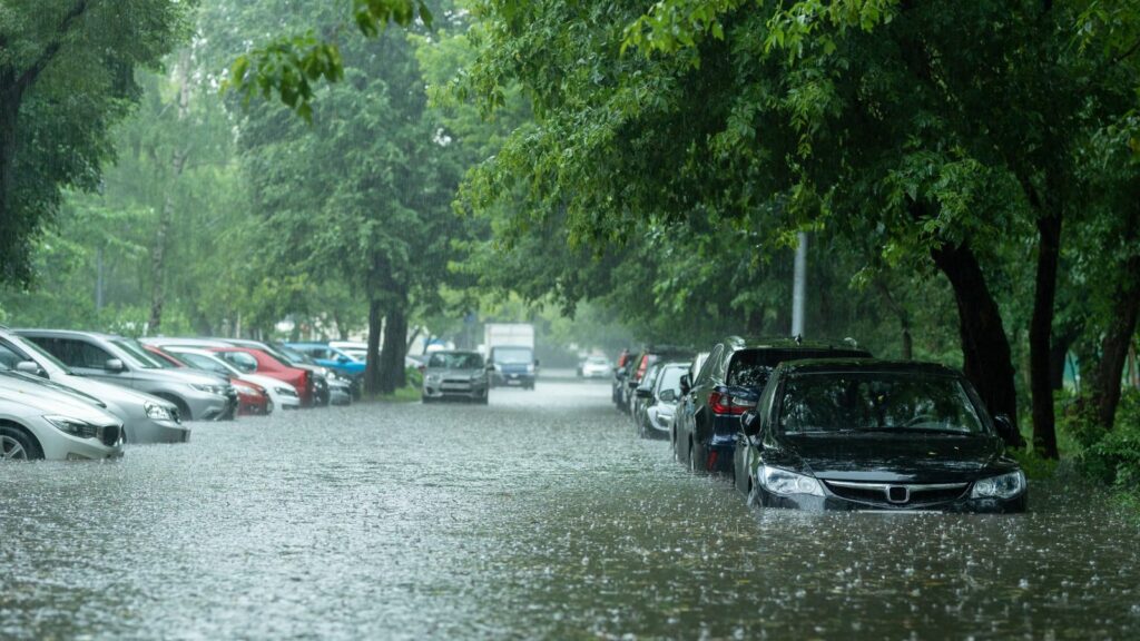
Among the most striking scenes recorded during the flooding was a vehicle sitting submerged on the Don Valley Parkway. Images distributed by Anadolu Agency through Reuters Connect showed the vehicle surrounded by floodwater after the Don River overflowed. Other vehicles could be seen waiting near the closed portion of the highway as traffic was diverted.
The available reporting did not establish what happened to the occupants of that particular vehicle, so conclusions about injuries or rescue circumstances would go beyond confirmed information. What the image does show clearly is the speed with which an ordinary roadway can become hazardous when water rises. Floodwater can conceal curbs, debris, damaged pavement and changes in road elevation. Toronto officials consequently urged motorists to avoid flooded areas entirely rather than attempting to judge whether standing water was shallow enough to cross.
Rain Fell Fast Enough to Overwhelm Low-Lying Routes
Environment and Climate Change Canada had warned before the storms arrived that Toronto could see torrential downpours producing local rainfall amounts of up to 50 millimetres. The alert also identified the possibility of damaging wind gusts above 110 km/h, large hail and a tornado risk as a cold front moved through southern Ontario.
Rainfall varied widely across the region. CityNews reported Toronto and Region Conservation Authority measurements ranging from roughly 3 to 97 millimetres across its watersheds on September 2, after parts of Toronto had already received substantial rain on August 31. Pearson Airport reported about 40 millimetres from the storm. The concern was therefore not simply the citywide average but how intensely rain fell in particular watersheds. When large volumes arrive over a short period, runoff can collect faster than rivers, drains and other infrastructure can move it away.
The Don Valley’s Geography Leaves Little Margin
Flooding on the DVP is not an entirely new problem. Much of the highway runs beside the Don River at the bottom of a natural valley, placing transportation infrastructure close to a waterway that must carry runoff from a heavily urbanized watershed. The construction of the parkway itself involved major alterations to the valley, including rerouting approximately 3.2 kilometres of the Don River.
Historical flood-management documents have repeatedly identified transportation infrastructure along the Lower Don as vulnerable when river levels rise. The river has been channelized and reinforced over many decades to protect nearby roads, rail lines and utilities, yet sections of the valley remain susceptible during major storms. This helps explain why flooding can appear dramatic on the DVP even when conditions may seem less severe in neighbourhoods only a few kilometres away. Water naturally concentrates in the valley, leaving low-lying roads with limited room for error.
Closures Spread Beyond the Don Valley Parkway
The DVP was only one part of a much broader transportation problem. During the storm and its aftermath, flooding affected portions of the Gardiner Expressway, Lake Shore Boulevard, Bayview Avenue and several downtown streets. City officials also closed numerous ramps while crews assessed water levels, sediment and debris.
Even after some DVP lanes reopened the next morning, restrictions remained. The City reported that portions of the eastbound Gardiner and northbound DVP corridor remained closed from the Jarvis-area connection toward Bloor, while Bayview Avenue was also affected. Such closures can produce delays well beyond the flooded location because Toronto’s expressways and downtown arterial streets are closely interconnected. When one major route loses capacity, vehicles are pushed onto alternatives that may already be carrying heavy traffic, meaning a flood concentrated along one river valley can quickly become a citywide commuting problem.
Transit Was Hit at the Same Time
Drivers were not the only commuters facing disruption. Flooding also affected Toronto’s transit network during the storm. CityNews reported that subway trains bypassed St. Patrick and Union stations during portions of the event, while flooding and weather conditions triggered changes elsewhere across the system.
The TTC had prepared for heavy weather earlier in the day by placing its Transit Control Centre on alert and planning for slower operation, track monitoring and possible diversions in low-lying locations. That preparation did not eliminate disruption, but by the next morning the City reported that regular TTC service was operating. The episode demonstrated why transportation resilience cannot be considered one road or rail line at a time. When a highway floods while subway stations and surface routes are also dealing with water, fallen branches or power problems, commuters lose several alternatives simultaneously and recovery becomes a coordinated citywide exercise.
Tens of Thousands Lost Power
The storm also produced widespread electrical outages. Toronto Hydro reported a peak of approximately 65,000 customers without electricity during the event. By the next morning, the utility said power had been restored to roughly 90 per cent of affected customers, leaving about 6,000 still without service.
Downed trees and damaged electrical equipment complicated restoration efforts, and outages affected some traffic signals. The City instructed motorists to treat intersections with non-functioning lights as four-way stops. That becomes especially important after a violent storm, when roads may already be partially blocked by branches, standing water or emergency vehicles. Toronto Hydro also warned people to remain at least 10 metres away from downed power lines and to assume wires were energized. While flooded expressways attracted much of the public attention, damaged electrical infrastructure created another layer of risk on neighbourhood streets across Toronto.
Hospitals and Major Venues Also Felt the Impact
The storm’s effects reached facilities that normally remain operational even when weather deteriorates. Michael Garron Hospital reported flooding in its emergency department but said the department remained operational. People with urgent but non-life-threatening concerns were encouraged to consider other available options while staff dealt with the situation.
Elsewhere, Rogers Stadium sustained what operator Live Nation described as significant storm damage. The company said it was assessing the extent of the damage and reported no injuries among employees or contractors. Those incidents illustrated how severe weather can create problems far removed from a riverbank. A hospital must continue providing care while managing water intrusion, while a large venue must evaluate structural and operational safety before activities resume. For emergency planners, those simultaneous demands are important because they compete for crews, equipment and attention during the same short period.
The Cleanup Continued Long After the Water Fell
Reopening a flooded highway involves more than waiting for water levels to drop. City crews spent the night removing sediment and debris, sweeping roadways and inspecting affected areas. Around 1,100 storm-related service requests had been submitted to Toronto by the next day, giving officials a long list of flooded locations, fallen trees and other hazards requiring attention.
The southbound DVP was able to reopen the morning after the storm, although other portions and ramps remained restricted while cleanup continued. Heavy machinery could be seen removing muck left behind after the Don River receded. That residue matters because mud, gravel and branches can reduce traction or block drains even when pavement looks passable from a distance. City officials said routes would remain closed until cleanup was complete and the roadway was considered safe, emphasizing that falling water levels do not automatically mean normal traffic can resume.
Toronto Has Been Here Before
For many residents, images of the submerged DVP brought back memories of July 2024, when intense rainfall produced major flooding across Toronto. More than 100 millimetres fell in some areas during that event, flooding the DVP and other transportation corridors and forcing emergency crews to rescue stranded motorists.
The financial consequences were substantial. Insurance Bureau of Canada estimated that the July 15-16, 2024 flash floods in Toronto and southern Ontario caused more than $940 million in insured damage. Another southern Ontario flooding event one month later pushed insured flood losses from those two summer events above $1 billion. Earlier events have been costly as well: Toronto’s July 2013 storm became another landmark example of transportation disruption and property damage. Repeated episodes have made flooding less of an abstract planning concern and more of a recurring operational risk.
The Bigger Question Is How Toronto Adapts
Toronto has been expanding efforts aimed at reducing flood damage, including upgrades to stormwater infrastructure and a larger Basement Flooding Protection Subsidy Program. In May 2026, the maximum available subsidy for eligible residential properties increased from $3,400 to $6,650 for measures including sump pumps, backwater valves and plumbing assessments.
Large public projects are also changing parts of the Don River system. The Port Lands Flood Protection project reached substantial completion in 2025, creating a new naturalized river valley and floodplain near the mouth of the Don. That project protects a different portion of the watershed and does not make the DVP immune to flooding upstream. The September storm therefore underlines the scale of the challenge: protecting homes, highways, transit lines and utilities requires multiple layers of infrastructure, emergency response and land-use planning rather than a single engineering fix.
